Filter By
- Book
- Qty in Cart
- Quantity
- Price
- Subtotal
-

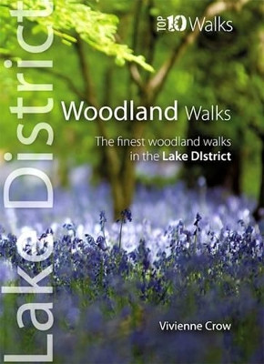
Woodland Walks: The Finest Woodland Walks in the Lake District by Vivienne Crow 9781908632210
RRP: $9.02Booksplease Price: $7.11This attractive and cleverly structured guide gives walkers ten of the finest walks through the woods and forests of the Lake District National Park in a popular pocketable format. With clear information, an overview and introduction for each walk,... -

The Campsies and the Kilpatrick Hills: 40 favourite walks by Douglas Milne
Booksplease Price: $8.29The Campsie Fells, along with the Kilpatrick, Kilsyth, Fintry and Gargunnock Hills, form a sprawling upland range which stretches eastwards from Dumbarton, passing to the north of the city of Glasgow and across the narrow waist of Scotland towards... -

Cinque Terre and the Riviera di Levante: 50 long and short walks with GPS Georg Henke 9781856914970
RRP: $16.76Booksplease Price: $12.86Walks throughout the iconic Cinque Terre and entire Riviera di Levante - from La Spezia in the south to Genoa in the. Large-scale walking maps (1:50,000) and free downloadable GPS tracks. Fold-out area map. Of particular interest to those who have... -

Wayfarer: Love, loss and life on Britain’s ancient paths by Phoebe Smith 9780008566524
RRP: $21.92Booksplease Price: $17.48A woman’s tale of the transformative power of walking Britain’s ancient pilgrim paths ‘Raw, honest, powerful. I couldn't put it down.’ Cerys Matthews On an assignment to walk the most famous pilgrimage in the world – the... -

Coastal Pub Walks: Dorset: Walks to amazing pubs along the South West Coast Path by Fiona Barltrop 9781908632876
Booksplease Price: $8.29One of seven books in the new Top 10 Walks: South West Coast Path series, these attractive and cleverly structured guides will give walkers ten of the best short circular walks along each of the five sections of the 630-mile long South West Coast Path in... -

Walking Hampshire's Test Way: The long-distance trail and 15 day walks by Malcolm Leatherdale 9781852849535
RRP: $19.29Booksplease Price: $14.19Guidebook to walking Hampshire's Test Way, a 44 mile (71km) route from Inkpen Beacon to the Eling Tide Mill near Southampton Water. The walk, which is described over eight stages, takes in many of the region's natural, historical and architectural... -

Picos de Europa Guide: 25 long and short walks with detailed maps and GPS; car tour with pull-out map Teresa Farino 9781856915359
RRP: $19.34Booksplease Price: $19.30The go-to Picos de Europa travel guide for discovering the best walks and car tours. Strap on your boots and discover Picos de Europa on foot with the Sunflower Picos de Europa travel guide. And on the days when your feet may have had enough, enjoy... -

Walks to the Hidden Waterfalls of Mid and North Wales by Des Marshall
Booksplease Price: $8.51Apologies but we at Booksplease don't have a full description for this book.Book InformationISBN 9781908748294Author Des MarshallFormat PaperbackPage Count 40Imprint Kittiwake PressPublisher Kittiwake Press -

Short Walks in the Lake District: Windermere Ambleside and Grasmere by Lesley Williams
RRP: $12.84Booksplease Price: $9.97Jonathan and Lesley Williams have chosen 15 of the best short walks around Windermere, Ambleside and Grasmere for you to explore. Our guide comes with easy-to-read Ordnance Survey maps and clear route descriptions, perfect if you're new to walking or are... -

Southern Tenerife and La Gomera Sunflower Walking Guide: 70 long and short walks with detailed maps and GPS; 6 car tours with pull-out map Noel Rochford 9781856915540
RRP: $20.63Booksplease Price: $15.89The go-to Southern Tenerife and La Gomera travel guide for discovering the best walks and car tours. Discover La Gomera and Southern Tenerife on foot with the Sunflower Southern Tenerife and La Gomera travel guide. And on the days when your feet may... -

Thames Path, Trailblazer British Walking Guide: Thames Head to Woolwich (London) - Thames Head: 89 Large-Scale Walking Maps & Guides to 99 Towns & Villages: Planning, Places to Stay, Places to Eat by Joel Newton 9781912716272
RRP: $16.76Booksplease Price: $12.86Follow the path of Britain's best-known river from London to the Cotswolds or from the Cotswolds to London. Here is all the information you need to walk the Thames Path. The Trailblazer Thames Path Guide is a practical, all-in-one, two-way guide to... -

The Wye Valley Walk: From Plynlimon to Chepstow The Wye Valley Walk Partnership (Ruth) 9781786311986
RRP: $21.87Booksplease Price: $16.33The official guidebook to walking the Wye Valley Walk, from the river’s source on the slopes of Plynlimon through the countryside of the Wales–England border region to Chepstow. Covering 219km (136 miles), this straightforward trail takes around 10 days... -

Lowland Outcrops by Topher Dagg 9781907233470
Booksplease Price: $35.60From Ayrshire, into the Central Belt and up to the Stirlingshire hills, the Lowland regions of Scotland are within easy travel distance of its two main cities and the majority of its climbing population. Though perhaps lacking the grandeur of the... -

Brecon Beacons by Harvey Map Services Ltd. 9781851375035
Booksplease Price: $22.63Brecon Beacons - the latest edition to the popular British Mountain Map series. It covers 350 square mile of country - the only really detailed map to cover this whole area on one sheet. These maps are a leap forward in technical excellence. Tough,... -

Be Expert with Map and Compass by Bjorn Kjellstrom 9780470407653
RRP: $24.51Booksplease Price: $18.05The classic map and compass navigation guide-revised for the age of GPS GPS devices are great, but they can break, get lost, or easily be hampered by weather conditions, making basic map and compass skills essential for anyone who spends time outdoors... -

A Tour Along the Sussex Coast by David Arscott 9781906022174
RRP: $11.60Booksplease Price: $9.55Apologies but we at Booksplease don't have a full description for this book.Book InformationISBN 9781906022174Author David ArscottFormat HardbackPage Count 96Imprint Snake River Press LtdPublisher Snake River Press Ltd -

Pub Walks in the Chilterns Alan Charles 9781846741326
RRP: $12.89Booksplease Price: $11.86A bestseller from the day it was first published, PUB WALKS IN THE CHILTERNS has again been completely revised and re-walked for this new edition by local author Alan Charles. If you enjoy both walking and visiting country pubs, this book should... -

Walking on Uist and Barra: 40 coastal, moorland and mountain walks on all the isles of Uist and Barra Mike Townsend 9781786311443
RRP: $21.87Booksplease Price: $16.33A guidebook to 40 walks on the Scottish islands of Berneray, North Uist, Benbecula, South Uist, Eriskay, Barra, Vatersay and Mingulay in the Outer Hebrides. From short easy walks to demanding hill walks, many on pathless terrain, there are routes to suit... -

North Downs Way Map Booklet by Kev Reynolds 9781852849559
RRP: $12.84Booksplease Price: $9.97This map booklet contains all the mapping you need to complete the 130 mile (208km) North Downs Way National Trail between Farnham and Dover. One of the easier National Trails, it can be comfortably walked in 11-12 days and includes an optional visit to... -

Hike by DK Eyewitness
Booksplease Price: $21.29It's hard to beat the satisfaction of travelling on foot - settling into a steady rhythm, surrounded by incredible scenery, with the freedom to stop wherever takes your fancy. This endlessly rewarding - and sustainable - activity is joyously celebrated... -

The Slovene Mountain Trail: Slovenska planinska pot Justi Carey 9781786310200
RRP: $24.45Booksplease Price: $18.02A guidebook to walking the Slovene Mountain Trail (Slovenska planinska pot or Transverzala) between Maribor near the Austrian border and Ankaran on the Adriatic Coast. Covering 550km (342 miles), this long-distance trek crosses Slovenia's Julian Alps and... -

Cumbria Coast: 40 Coast & Country Walks by Darren Flint 9781907025990
Booksplease Price: $8.29Much quieter than the nearby Lake District. This book features 40 short walks exploring the best the area has to offer. Look one way and marvel at the majesty of The Lake District's magnificent peaks, the other to find tranquil sea views of the Isle of... -

Walking in Cumbria's Eden Valley: 30 walks between the Yorkshire Dales and the Solway salt marshes by Vivienne Crow 9781852849016
RRP: $16.71Booksplease Price: $12.50A guidebook to 30 day walks in Cumbria's Eden Valley. Exploring the varied landscapes between the Eden's source in the upland Yorkshire Dales and its mouth at the Solway salt marshes, there are walks suitable for all abilities that can be enjoyed... -

Mountain and Hill Walking in Snowdonia: v. 2 by Carl Rogers
RRP: $14.18Booksplease Price: $12.95Following the success of "A Pocket Guide to Snowdonia's best Mountain Walks" published in 2007, Mara Books have launched Carl Rogers' new book "Mountain and Hill Walking in Snowdonia", a two-volume in-depth pocket sized guide to mountain walks in the... -

The England Coast Path - Book 1: The South Coast by Christopher Goddard
Booksplease Price: $17.22Apologies but we at Booksplease don't have a full description for this book.Book InformationISBN 9781913625092Author Christopher GoddardFormat PaperbackPage Count 352Imprint Gritstone PublishingPublisher Gritstone Publishing -

The Hard Way: Discovering the Women Who Walked Before Us by Susannah Walker 9781800183452
RRP: $21.92Booksplease Price: $16.02'The Hard Way is a powerful manifesto for women who long to walk alone – and safely – in the countryside' Dr. Sharon Blackie, author of If Women Rose RootedWhy is it radical for women to walk alone in the countryside, when men have been doing so for... -

Guide to Lincolnshire Pub Walks by Catherine Smith 9781846743504
RRP: $9.02Booksplease Price: $8.94Discover Lincolnshire's beautiful countryside with this guide to some of the best walks in the county. The 15 circular routes vary in length from 4 to 7 miles and are centred on a broad variety of pubs - many of them award-winning, and all recommended... -

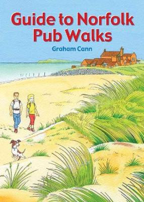
Guide to Norfolk Pub Walks by Graham Cann 9781846743627
RRP: $9.02Booksplease Price: $8.29Discover Norfolk's beautiful countryside with this guide to some of the best walks in the county. The 20 circular routes vary in length from 2 to 6 miles and are centred on a broad variety of pubs, all recommended for their good food and warm welcome. ... -

The Haunted Trail: Classic Tales of the Rambling Weird Weird Walk 9780712355810
RRP: $14.18Booksplease Price: $11.02A remarkable blood-soaked stranger upends the lives of two Lake District ramblers; a lonely tavern offers its guests something much more disturbing than a post-walk pint; a night hike on the Fens takes a terrifying turn when the fog rolls in. From the... -

On Sacred Ground: A 7,000-mile Walk of Discovery into the Heart of Wild Nature by Andrew Terrill 9781737068624
Booksplease Price: $19.29Apologies but we at Booksplease don't have a full description for this book.Book InformationISBN 9781737068624Author Andrew TerrillFormat PaperbackPage Count 410Imprint Enchanted Rock Press, LLCPublisher Enchanted Rock Press, LLCWeight(grams)... -

London's Hidden Walks: Volumes 1-4 Susi Koch 9781902910802
RRP: $51.59Booksplease Price: $42.75People love walking the streets of London, but there are always more questions than answers after a stroll through the capital. These books are packed with interesting details about London’s history with both personal tales of those who wandered the same... -

The Blackbird's Song & Other Wonders of Nature: A year-round guide to connecting with the natural world Miles Richardson 9781915780256
RRP: $19.34Booksplease Price: $14.04'A wonderful "rough guide" to the planet we live on... Read it and pass it on as a gift of love from you to those around you so they can learn to feel comfortable in their own skins and ultimately, be happy.' Sir Tim Smit, The Eden Project An almanac,... -

The Northumberland Coast Path: Official Guidebook by Iain Robson 9781739486112
RRP: $12.84Booksplease Price: $11.80Apologies but we at Booksplease don't have a full description for this book.Book InformationISBN 9781739486112Author Iain RobsonFormat PaperbackPage Count 64Imprint Northern HeritagePublisher Northern Heritage Services -

Orkney by Mark Rowe 9781804690963
RRP: $21.92Booksplease Price: $17.48This thoroughly updated second edition of Bradt's guidebook to the alluring Scottish archipelago of Orkney is written by experienced author and journalist Mark Rowe, who is something of a specialist on the more remote parts of Scotland. Bradt's guidebook... -

Top Walks in East Cornwall: Thirteen Circular Walks Through Stunning Cornish Scenery by Liz Hurley
Booksplease Price: $12.89Apologies but we at Booksplease don't have a full description for this book.Book InformationISBN 9780993218088Author Liz HurleyFormat PaperbackPage Count 107Imprint Mudlark's PressPublisher Mudlark's Press -

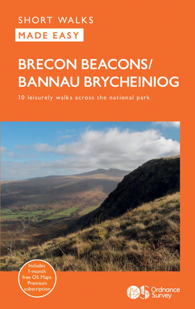
Brecon Beacons by Ordnance Survey 9780319092743
RRP: $11.60Booksplease Price: $9.74Each walk features a simple-to-follow route profile and accompanying description and pictures, and new-look walk mapping that makes it easier for the user to focus on the route and the points of interest along the way.Book InformationISBN... -

The Ridgeway by Jon Cox 9781739411213
Booksplease Price: $15.42Apologies but we at Booksplease don't have a full description for this book.Book InformationISBN 9781739411213Author Jon CoxFormat PaperbackPage Count 96Imprint Sparky BooksPublisher Sparky Books -

The Bone Cave: A Journey through Myth and Memory by Dougie Strang 9781780278353
RRP: $19.34Booksplease Price: $14.36This is a book about stories - old stories of people and place, and of the more-than-human world. A vivid account of a journey through the Scottish Highlands, The Bone Cave follows a series of folktales and myths to the places in which they're set... -

Walking with Saints and Tinners: A walking guide to the longer routes in Cornwall by Liz Hurley 9781913628062
RRP: $16.76Booksplease Price: $12.93Apologies but we at Booksplease don't have a full description for this book.Book InformationISBN 9781913628062Author Liz HurleyFormat PaperbackPage Count 120Imprint Mudlark's PressPublisher Mudlark's Press -

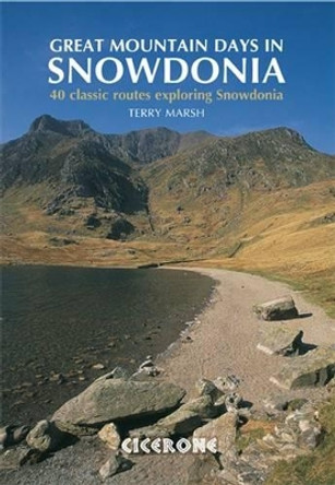
Great Mountain Days in Snowdonia: 40 classic routes exploring Snowdonia Terry Marsh 9781852845810
RRP: $24.45Booksplease Price: $18.41A guidebook to 40 great mountain walks and scrambles in Snowdonia. The inspirational routes in this larger format book range right across the Snowdonia National Park and are divided into 8 geographical regions: Snowdon and Moel Eilio, the Glyderau, the...
