Filter By
- Book
- Qty in Cart
- Quantity
- Price
- Subtotal
-

Guide To Wiltshire Pub Walks by Nigel Vile 9781846743580
Booksplease Price: €7.40Discover the beauty of the Wiltshire countryside with this guide to some of the best walks in the area. There are 20 circular routes here, varying in length from 21/2 to 61/2 miles, all of which take in welcoming pubs renowned for their excellent food... -

The South Pennines: 40 Favourite Walks by Alastair Ross 9781907025730
RRP: €8.32Booksplease Price: €7.49The home of Heathcliffe and Nora Batty, the wild and wuthering South Pennines is where Yorkshire and Lancashire collide, a watershed landscape of great natural beauty which is home to proud and welcoming communities with a heritage of rugged farming and... -

Lonely Planet Epic Hikes of the World 1 Lonely Planet 9781838694548
RRP: €17.84Booksplease Price: €14.14With stories of 50 incredible hiking routes in 30 countries, from New Zealand to Peru, plus a further 150 suggestions, Lonely Planet's Epic Hikes of the World will inspire a lifetime of adventure on foot. From one-day jaunts and urban trails to... -

The Eastern Fells: Wainwright's Walking Guide to the Lake District Fells Book 1 by Alfred Wainwright
RRP: €17.84Booksplease Price: €12.20One name above all others has become associated with walking in the Lake District: Alfred Wainwright, whose seven-volume Pictorial Guide to the Lakeland Fells, first published in 1955- 66, has become the definitive guidebook. ... -

Walking the South West Coast Path: A Companion Guide by Simon Butler 9780857100979
RRP: €15.46Booksplease Price: €10.44Apologies but we at Booksplease don't have a full description for this book.Book InformationISBN 9780857100979Author Simon ButlerFormat HardbackPage Count 144Imprint PiXZ BooksPublisher PiXZ Books -

The Cairngorms & North-East Scotland by Iain Young 9781907233487
RRP: €41.65Booksplease Price: €35.69From Angus in the south to the farmland of Moray in the north, the forests, moors and lochs of North-East Scotland lead upwards to a vast plateau of tundra studded with glacier-carved corries and glens - the Cairngorms. Here, across an expanse of 8,000... -

Coastal Pub Walks: South Devon: Walks to amazing publs along the South West Coast Path by Fiona Barltrop
RRP: €8.32Booksplease Price: €7.49One of seven books in the new Top 10 Walks: South West Coast Path series, these attractive and cleverly structured guides will give walkers ten of the best short circular walks along each of the five ssections fo the 630-muile long Sout West Coast Path... -

Walking in Italy's Cinque Terre: Monterosso al Mare, Vernazza, Corniglia, Manarola and Riomaggiore by Gillian Price 9781852849733
RRP: €21.36Booksplease Price: €13.34A guidebook to 16 walks in Italy's Cinque Terre. Following age-old paths linking the UNESCO-listed settlements of this beautiful coastline, the routes involve moderate to steep ascents and therefore call for a reasonable level of fitness. ... -

Trekking the GR11 Trail: The Traverse of the Spanish Pyrenees - La Senda Pirenaica by Tom Martens 9781786311665
RRP: €22.55Booksplease Price: €15.03A guidebook to hiking the 850km (520 mile) GR11 (La Senda Pirenaica) trail between Irun on the Atlantic coast and Cap de Creus on the Mediterranean. Over the years it has become a well-defined hiking trail which mostly goes over good hiking paths through... -

Hadrian's Wall Path: Easy-to-use folding map and essential information, with custom itinerary planning for walkers, trekkers, fastpackers and trail runners by 9781839810312
RRP: €17.79Booksplease Price: €11.03The 138-kilometre Hadrian's Wall Path traces a grey line along Great Whin Sill, the dolerite ridge chosen by the Romans for their historic wall. The route, one of Britain's most popular National Trails, is dotted with milecastles and forts, and attracts... -

The Coast to Coast Map Booklet: 1:25,000 OS Route Map Booklet by Terry Marsh 9781852849269
RRP: €15.41Booksplease Price: €10.59A booklet of all the mapping needed to complete the Coast to Coast Path National Trail, originally conceived by Alfred Wainwright. Suited to experienced walkers, the 302km (188 mile) C2C passes through the Lake District, Yorkshire Dales and North York... -

Hiking Canada's Great Divide Trail - 4th Edition by Dustin Lynx
RRP: €29.74Booksplease Price: €20.19Apologies but we at Booksplease don't have a full description for this book.Book InformationISBN 9781771605496Author Dustin LynxFormat PaperbackPage Count 368Imprint Rocky Mountain BooksPublisher Rocky Mountain Books -

Edinburgh: Weekend Walks by Nick Drainey
RRP: €8.32Booksplease Price: €7.49Edinburgh is one of the most richly layered historical cities in the world, with the medieval layout of the Old Town and the neoclassicism of the Georgian New Town attracting visitors from all over the world. Like Rome, Edinburgh has its Seven Hills,... -

Walk! the Brecon Beacons by Bob Greaves 9781904946175
RRP: €15.46Booksplease Price: €11.35Travel Book of the Week. As a wannabe walker, I'm much taken with the Discovery Walking guides new Walk! UK series which covers all the major walking destinations from the Lake District to Exmoor. Walk! The Brecon Beacons, GBP12.99 by Bob Greaves, is a... -

The South Downs Way Map Booklet: 1:25,000 OS Route Mapping by Kev Reynolds
RRP: €15.41Booksplease Price: €10.28All the mapping you need to complete the 100 mile (160km) South Downs Way National Trail, between Eastbourne and Winchester. With easy walking on ancient trackways, the route features wooded areas, river valleys and attractive villages and is rich in... -

Trekking the Cleveland Way: Two-way guidebook with OS 1:25k maps: 20 different itineraries by Andrew McCluggage 9781912933174
RRP: €20.22Booksplease Price: €16.36The definitive two-way guide to the Cleveland Way, one of England's epic National Trails: both eastbound and westbound routes are described in full. Real Maps: Full Ordnance Survey mapping inside (1:25,000). All accommodation is numbered and marked on... -

Walks for All Ages Lincolnshire: 20 Circular Walks by Hugh Marrows 9781909914810
RRP: €8.32Booksplease Price: €6.52Apologies but we at Booksplease don't have a full description for this book.Book InformationISBN 9781909914810Author Hugh MarrowsFormat PaperbackPage Count 96Imprint Bradwell BooksPublisher Bradwell BooksWeight(grams) 195gDimensions(mm) 220mm * 120mm *... -
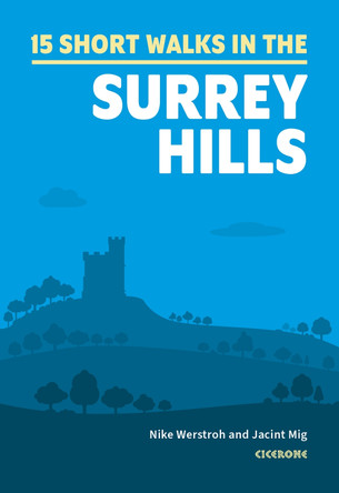
Short Walks in the Surrey Hills by Nike Werstroh
RRP: €11.84Booksplease Price: €8.40Nike Werstroh and Jacint Mig have chosen 15 of the best short walks around the Surrey Hills for you to explore. Our guide comes with easy-to-read Ordnance Survey maps and clear route descriptions, perfect if you're new to walking or are looking for... -

Mountain and Moorland Navigation: A Practical Manual: Essential Knowledge for Finding Your Way on Land by Kevin Walker 9781906095567
RRP: €17.84Booksplease Price: €15.27Kevin sums up his approach to navigation as follows: "Successful navigation should be simple and straightforward, and when done correctly, it will enhance the pleasure you get from the outdoors, not detract from it." His book reflects this view and is a... -
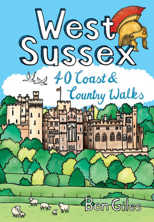
West Sussex: 40 Coast & Country Walks by Ben Giles 9781916739024
RRP: €8.32Booksplease Price: €7.49From the city of Chichester with its ancient walls and harbour inlets standing sentinel over the English Channel to the northern heights of Black Down on its ridge of greensand above the intervening folds, farms and villages of the western Weald, from... -

Arrochar Alps: XT25 by 9781851376063
RRP: €18.45Booksplease Price: €16.17Includes Beinn Ime, Ben Vorlich and the Cobbler (Ben Arthur). Detailed map for hillwalkers of the western part of the Loch Lomond and Trossachs National Park at the popular scale of 1:25,000. Includes 5 Munros, 10 Corbetts and 13 Grahams. Tough, light,... -

Lonely Planet New Zealand's North Island Lonely Planet 9781787016057
RRP: €16.65Booksplease Price: €11.90Lonely Planet's New Zealand's North Island is your passport to the most relevant, up-to-date advice on what to see and skip, and what hidden discoveries await you. Experience Pacific Island culture, black-water raft or explore trendy Wellington; all with... -

Cotswold Classic Walks by William Fricker
RRP: €17.84Booksplease Price: €11.88Apologies but we at Booksplease don't have a full description for this book.Book InformationISBN 9781859652916Author William FrickerFormat PaperbackPage Count 136Imprint GoldeneyePublisher Goldeneye -

Walking in Zermatt and Saas-Fee: 50 routes in the Valais: Mattertal and Saastal Lesley Williams 9781786310750
RRP: €21.36Booksplease Price: €14.29A guidebook to 50 graded day walks in Switzerland's Valais. Exploring the areas around the towns of Zermatt and Saas-Fee in the Mattertal and Saastal valleys, the walks are suitable for beginner and experienced walkers alike. Walks range from... -

Fort William and Lochaber: 40 Favourite Walks by Keith Fergus 9781907025457
RRP: €8.32Booksplease Price: €7.49With the historic town of Fort William at its heart, Lochaber boasts some of Scotland's most celebrated mountains and glens, beautiful sea lochs and, on the craggy west coast, dazzling white sandy beaches. Ben Nevis may draw the crowds, but with... -

Day Walks in the Peak District: 20 classic circular routes by Norman Taylor 9781906148492
RRP: €17.79Booksplease Price: €12.85Day Walks in the Peak District - 20 classic circular routes features 20 circular walks, between 8.25 and 12 miles (13 and 19.5 kilometres) in length, suitable for hillwalkers of all abilities.The routes are split into three areas - The High Moors, Hills... -

Walking in the Cairngorms: Over 100 walks, trails and scrambles including Lochnagar by Ronald Turnbull 9781852848866
RRP: €17.79Booksplease Price: €11.82A guidebook to over 100 walking routes in the Cairngorms and Lochnagar. Sitting between Speyside and Deeside the Cairngorms National Park provides the backdrop for these low- and high-level walks and scrambles suitable for a range of abilities. ... -

The Lea Valley Walk: Leagrave to the heart of London Leigh Hatts 9781852847746
RRP: €15.41Booksplease Price: €13.03Guidebook to the Lea Valley Walk, a 53-mile long-distance path from Luton to the Thames. It follows the River Lea from its source near Leagrave to East India Dock opposite Greenwich, with an alternative finish at Limehouse and an optional tour of the... -

Leicestershire Round by Leicestershire Footpath Association 9781527206229
RRP: €11.84Booksplease Price: €10.29Apologies but we at Booksplease don't have a full description for this book.Book InformationISBN 9781527206229Author Leicestershire Footpath AssociationPage Count 114Imprint Leicestershire Footpath AssociationPublisher Leicestershire Footpath Association -

Ben Nevis and Glen Coe: 100 low, mid, and high level walks by Ronald Turnbull
RRP: €20.17Booksplease Price: €13.78A guidebook to 100 walks in the Ben Nevis and Glen Coe region. Routes are graded according to difficulty, and range between short, easy strolls and long, challenging walks with overnight bothy stays.The walks range in length from 2 to 34km (1-21 miles)... -

The High Tatras: Slovakia and Poland - Including the Western Tatras and White Tatras RenA!ta NA!roznA! 9781852848873
RRP: €22.55Booksplease Price: €15.27Guidebook blending inspiration and information about 180 walks and scrambles in the High Tatras mountains of Poland and Slovakia. Varied routes among the strikingly beautiful craggy peaks of the High, Western and White Tatras range from easy to... -

The Fife Pilgrim Way: Culross/North Queensferry - St Andrews by 9781916002913
RRP: €11.84Booksplease Price: €11.75A handy, waterproof map breaking down the Fife Pilgrim Way into seven sections. The Fife Pilgrim Way runs between North Queensferry or Culross and St Andrews. It is designed as a varied route for residents and visitors alike, and it is possible to... -
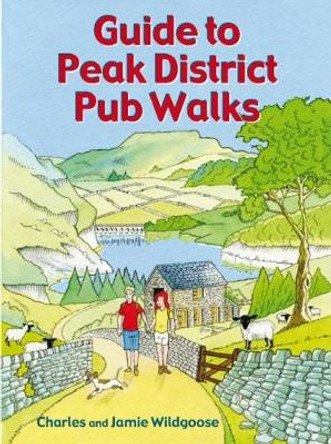
Guide to Peak District Pub Walks by Charles Wildgoose 9781846743467
RRP: €8.32Booksplease Price: €7.52Discover the beauty of the Peak District with this guide to some of the finest walking in the country. Routes include walks beside Dovestone, Ladybower and Redmires reservoirs, the Monsal Trail, and the ancient hillfort of Carl Wak. Explore the... -

Pathfinder Essex by Deborah King 9780319091166
RRP: €15.46Booksplease Price: €11.35The Essex landscape gently undulates, with the highest ground to the north and west, near the Herfordshire and Cambridgeshire borders. A variety of routes are selected across the county to give a broad flavour of the county's landscapes and heritage. On... -

Ambleside & South Lakeland: Short Scenic Walks by Paul Hannon 9781907626272
Booksplease Price: €5.94This colourful pocket-sized guide is your passport to 30 great walks around Ambleside and the southern half of the Lake District National Park. The principal feature is that all walks are no more than five miles in length, offering a perfect half day's... -

Walking the Old Ways of South Shropshire by Andy Johnson 9781910839348
RRP: €17.85Booksplease Price: €14.88Apologies but we at Booksplease don't have a full description for this book.Book InformationISBN 9781910839348Author Andy JohnsonFormat PaperbackPage Count 208Imprint Logaston PressPublisher Fircone Books Ltd -

South West Coast Path Map Booklet - Vol 1: Minehead to St Ives: 1:25,000 OS Route Mapping Paddy Dillon 9781786312181
RRP: €15.41Booksplease Price: €10.59A booklet of the mapping needed to walk the northern section of the 1015km (630 mile) South West Coast Path National Trail between Minehead and St Ives. The full route is shown on 1:25,000 OS maps The map booklet can be used to walk the trail... -

Scotland's Best Small Mountains: 40 of the best mountains in Scotland under 3000ft by Kirstie Shirra 9781786311320
RRP: €20.17Booksplease Price: €13.78A guidebook to 40 of the best small mountains in Scotland under 3000ft. Explore the beautiful scenery of Sutherland and the far north, Torridon, Lochaber, the Great Glen, the Cairngorms, Glencoe, Arrochar, the Trossachs and the islands (Skye, Eigg, Mull,... -

Thames Path in the Country: National Trail Guide David Sharp 9781781315750
RRP: €17.84Booksplease Price: €12.20The official guide to the riverside path from its Gloucestershire source all the way to the outskirts of London. With the London Thames now covered by Aurum' s separate new guide, a companion volume can concentrate on the appeal of the full... -

Trekking the GR7 in Andalucia: From Tarifa to Puebla de Don Fadrique by Guy Hunter-Watts
RRP: €22.55Booksplease Price: €15.27The GR7 is one of Europe's longest GR long-distance routes, stretching from Tarifa, the southernmost town of continental Europe, through Spain, Andorra and France to Alsace. This guide presents the Andalucian section of the route, which offers well over...
