Filter By
- Book
- Qty in Cart
- Quantity
- Price
- Subtotal
-

Ben Nevis XT25 by Harvey Map Services Ltd.
RRP: $32.55Booksplease Price: $28.54Ben Nevis with the Mamores and Grey Corries ranges at 1:25,000 on a double-sided, waterproof and tear-resistant map from Harvey Map Services in their Superwalker series, with the peak area also shown in greater detail at 1:12,500. The map divides the... -

Midlands A-Z Road Atlas A-Z Maps 9780008652838
RRP: $16.78Booksplease Price: $12.10A full-colour, regional road atlas of the Midlands from A-Z Maps, featuring 46 pages of continuous road mapping. Road map detail is shown at a clear 2.5 miles to 1 inch scale (1.58 km to 1 cm) and includes the following features: ... -

2024 Philip's Easy to Read: (A4 Paperback) by Philip's Maps
RRP: $33.58Booksplease Price: $20.03"The detail you need at a size you can read". The latest 2024 Easy to Read Britain Road Atlas from Philip's best selling Road Atlas range. A practical and chunky A4-sized paperback with handy flaps to help plan any journey.- Large print maps- Huge... -

Unforgettable Journeys Europe: Discover the Joys of Slow Travel by DK
RRP: $52.50Booksplease Price: $39.56Inspirational travel book covering 150 of Europe's most incredible journeys, including routes on foot and by bike, road, rail and water. When it comes to beautiful landscapes, Europe has more than its fair share of icons. The snowy peaks of the Alps, the... -

Fort William & Glen Coe: 2017 by 9780319090916
RRP: $27.28Booksplease Price: $20.03Fort William and Glen Coe encompass one of the greatest areas of sea and mountain landscape in Scotland, backed by some of the biggest and most demanding peaks. This is Scotland's fjord land, a drowned coastland with long sea arms wending far inland, and... -

Oxford A-Z Pocket Street Map by A-Z Maps 9780008657383
RRP: $8.38Booksplease Price: $7.14Navigate your way around Oxford with detailed street maps from A-Z This up-to-date, folded A-Z street map includes 1,600 streets in and around Oxford. As well as the University of Oxford colleges, the other areas covered are Jericho, Cowley,... -

An Historical Map of Kingston Upon Hull by David Neave 9780993469824
RRP: $23.08Booksplease Price: $17.14Apologies but we at Booksplease don't have a full description for this book.Book InformationISBN 9780993469824Author David NeaveImprint The Historic Towns TrustPublisher The Historic Towns Trust -

DK Eyewitness Italy DK Eyewitness 9780241673164
Booksplease Price: $37.80Get closer to Italy with DK Eyewitness. Marvelling at the ruins of the Roman Empire. Cycling around Tuscany's vineyard-cloaked hills. Indulging in world-famous regional cuisines. Italy offers enough bucket-list experiences to fill a lifetime. Whatever... -

Kent: 2016 by David Hancock 9780319090183
RRP: $27.28Booksplease Price: $20.03Walkers in Kent enjoy a number of long distance footpaths, including the North Downs Way, Wealdway, Pilgrims' Way and Greensand Way, and sections of them are incorporated into several walks in this guide. Routes starting at Tenterden and Penshurst wind... -

2025 Philip's Road Atlas Britain and Ireland: (A4 Spiral Binding) by Philip's Maps 9781849076685
RRP: $35.68Booksplease Price: $26.71'Good balance between detail and clarity with excellent town maps' What Car?PHILIP'S - Market leader and No. 1 in the UK for clear maps 2025 Philip's Road Atlas of Britain and Ireland is a top-of-the-range, A4-sized, spiral-bound atlas, featuring fully... -

2023 Philip's Easy to Read Road Atlas Britain: (A4 Paperback) Philip's Maps 9781849075954
RRP: $31.48Booksplease Price: $30.24"The detail you need at a size you can read". The newest 2023 Easy to Read Britain Road Atlas from Philip's- Large print maps- Huge 1:150,000 scale (approx 2.4 miles to 1 inch)- Large print place names- Large print index- Super-clear 10-page... -

South East England A-Z Road Atlas by A-Z Maps
RRP: $16.78Booksplease Price: $12.10This A-Z map of South East England is a full colour regional road atlas featuring 46 pages of continuous road mapping extending from Banbury and Felixstowe to the south coast, and from Oxford and Southampton to Margate and Clacton-on-Sea in the east. ... -

Philip's Local Explorer Street Atlas Lincolnshire Philip's Maps 9781849076043
RRP: $35.68Booksplease Price: $26.71Who hasn't explored and enjoyed their surrounding area recently and come to appreciate what is on our respective doorsteps? Philip's have created this new series for walkers, cyclists and local explorers at a scale that provides greener options to... -

Lough Erne by Ordnance Survey of Northern Ireland 9781905306268
Booksplease Price: $18.88The Lough Erne Activity map has recently received the Gold award for best map at the International Map Trade Association awards.The Lough Erne Activity map has recently received the Gold award for best map at the International Map Trade Association... -

The World Atlas of Gin: Explore the gins of more than 50 countries Joel Harrison 9781784725310
RRP: $54.60Booksplease Price: $37.23'Excellent' - Susy Atkins, the TelegraphFor everyone and anyone who wants to understand more about gin, this is the definitive guide - covering the best gins the world has to offer, history and production methods, and the countries that have helped make... -

Atlas of Unexpected Places: Haphazard Discoveries, Chance Places and Unimaginable Destinations Travis Elborough 9780711290815
RRP: $23.08Booksplease Price: $14.64Traverse the globe and explore the extraordinary. This is a unique, enigmatic collection of 45 meticulously crafted maps for wandering off the beaten track. Embark on an armchair expedition across nations and marvel at astounding spots only ever stumbled... -

Big Easy Read Britain 2024: 2024 9780749583323
RRP: $35.68Booksplease Price: $23.77This A3 format atlas provides giant scale mapping and type throughout making it very easy to use. It is available in two binding styles; paperback and spiral bound. Each page has been titled with its geographical location so you can turn to the page you... -

Istanbul PopOut Map PopOut Maps 9781914515668
RRP: $10.48Booksplease Price: $8.82Let PopOut Map Istanbul guide you around this wonderful city. Discover the Turkish delight of Istanbul city with the help of this genuinely pocket-sized, pop-up map. Small in size yet big on detail, this compact, dependable, Istanbul city map will... -

AA Road Map Northern England 9780749584122
RRP: $12.58Booksplease Price: $9.07Fully updated, the maps combine clear design and an easy-to-read scale with more road detail to ensure that you never lose your way. Each map includes information on toll points, service areas, road numbers, motorways, dual carriageways and wide and... -

Spain & Portugal 2025 - Michelin National Map 734 by Michelin 9782067265448
RRP: $14.68Booksplease Price: $11.28Updated annually, MICHELIN National Map Spain & Portugal (map 734) will give you an overall picture of your journey thanks to its clear and accurate mapping scale 1/1,000,000. Our National Map Series will help you easily plan your safe and enjoyable... -

Munro & Corbett Chart 9781851376766
RRP: $20.90Booksplease Price: $19.03This Munro map is a chart which shows and lists all Munros (mountains over 3000ft), Corbetts (over 2500ft), Grahams and Donalds (over 2000ft). A selection of other hills are named for information. Space for recording your date of ascent. Target to... -

Dog Walks between Truro and Fowey by Liz Hurley
RRP: $18.88Booksplease Price: $17.60Apologies but we at Booksplease don't have a full description for this book.Book InformationISBN 9780993218057Author Liz HurleyFormat PaperbackPage Count 92Imprint Mudlark's PressPublisher Mudlark's Press -

Gran Canaria, road and leisure map 1:50,000, freytag & berndt 9783707921755
RRP: $27.09Booksplease Price: $22.89The road and leisure map of Gran Canaria at a scale of 1:50,000 contains a lot of information that is useful and helpful for a trip to the largest of the Canary Islands. The branched road network is shown exactly, scenic roads are highlighted in color... -

DK Eyewitness Top 10 Honolulu and O'ahu by DK Eyewitness 9780241622346
RRP: $18.88Booksplease Price: $14.28Aloha! Explore the natural and cultural beauty of Honolulu and O'ahu on your next adventure.From clear water and turquoise coves, palm-shaded beaches and exhilarating surfing spots to rich historical, culinary and linguistic experiences, Honolulu is an... -

Offa's Dyke Map Booklet: 1:25,000 OS Route Mapping by Mike Dunn
RRP: $27.20Booksplease Price: $18.69All the mapping you need to walk the Offa's Dyke Path National Trail that runs for 177 miles along the English-Welsh border between Sedbury (near Chepstow) and Prestatyn on the north Wales Coast. NOTE An accompanying Cicerone guidebook - Offa's Dyke Path... -

Torbay A-Z Street Atlas by A-Z Maps
RRP: $16.78Booksplease Price: $12.10Navigate your way around Torbay with this detailed and easy-to-use A-Z Street Atlas. Printed in full-colour, paperback format, this atlas contains 38 pages of continuous street mapping. More than 5,100 streets indexed. Large scale 4 inches to... -

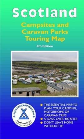
Scotland Campsites and Caravan Parks: Touring Map Alex Barclay 9780955304972
RRP: $21.00Booksplease Price: $18.12It's long been acknowledged that Scotland's 'great outdoors' is one of its biggest visitor attractions and that one of the best ways of experiencing its awesome scenery is on a camping, motorhome or caravan holiday. However, there is an extensive range... -

Snowdonia: 10 Leisurely Walks by 9780319092323
RRP: $14.68Booksplease Price: $11.51Each walk features a simple-to-follow route profile and accompanying description and pictures, and new-look walk mapping that makes it easier for the user to focus on the route and the points of interest along the way.Book InformationISBN... -

Arrochar Alps: Ultramap by 9781851376476
RRP: $24.15Booksplease Price: $21.65Covers a large area yet is handily compact. Pocket perfect! Includes Beinn Ime, Ben Vorlich and the Cobbler (Ben Arthur). Detailed map for hillwalkers of the western part of the Loch Lomond and Trossachs National Park at the magic scale of 1:40,000... -

Normandy Coast - Zoom Map 117 9782067209855
RRP: $14.68Booksplease Price: $11.07(Edition updated in 2023) MICHELIN zoom map Normandy Coast is the ideal travel companion to fully explore this French destination, thanks to its easy-to-use format and its scale of 1/150,000. Covers Dieppe, Rouen, Caen, St-Lo The Zoom collection are... -

Llangollen and Montgomery Canal by Heron Maps
RRP: $12.58Booksplease Price: $11.45Apologies but we at Booksplease don't have a full description for this book.Book InformationISBN 9781908851314Author Heron MapsFormat PaperbackPage Count 2Imprint Heron MapsPublisher Phoenix Maps -

Gibraltar in 2 days: An easy-read travel guide to get the most from your short break by James Richardson 9780995749245
RRP: $16.78Booksplease Price: $13.88Apologies but we at Booksplease don't have a full description for this book.Book InformationISBN 9780995749245Author James RichardsonFormat PaperbackPage Count 72Imprint Musselburgh PressPublisher James E Richardson (Electrical) LimitedDimensions(mm)... -

Devon, Cornwall and West Somerset Visitors' Atlas by Geographers' A-Z Map Company 9781843486459
RRP: $14.68Booksplease Price: $12.50This full colour atlas of Devon, Cornwall and West Somerset combines 32 pages of road mapping with an illustrated town plan section to provide an informative atlas and guide. The road map coverage includes the whole of Cornwall, Devon and the... -

2025 Philip's Big Road Atlas of Britain & Ireland: (A3 Spiral Binding) by Philip's Maps 9781849076647
RRP: $33.58Booksplease Price: $25.31'Good balance between detail and clarity with excellent town maps' What Car?PHILIP'S is No. 1 in the UK for clear maps. The latest 2025 Philip's Big Road Atlas of Britain and Ireland, in a supersize large format, has fully updated mapping from the... -

Ben Alder 9781851376599
RRP: $32.55Booksplease Price: $28.88Apologies but we at Booksplease don't have a full description for this book.Book InformationISBN 9781851376599Imprint Harvey Map Services LtdPublisher Harvey Map Services LtdWeight(grams) 62g -

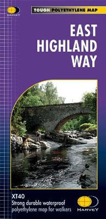
East Highland Way XT40: Route Maps by Harvey Map Services Ltd.
RRP: $33.50Booksplease Price: $29.72East Highland Way is an exciting new unofficial long distance route between Fort William and Aviemore. Pioneered by Kevin Langan, this 82 mile trail forms a new link between the northern end of the West Highland Way and the southern end of the Speyside... -

History of World Trade in Maps by Philip Parker
RRP: $52.50Booksplease Price: $38.03A beautful book for anyone interested in exploring the history of trade in maps. Trade is the lifeblood of nations. It has provided vital goods and wealth to countries and merchants from the ancient Egyptians who went in search of gold and... -

Moon Jamaica (Eighth Edition) by Oliver Hill
RRP: $29.38Booksplease Price: $20.27Dive in to warm Caribbean waters, soak up the sunshine, and discover the vibrant culture and spirit of Jamaica. Inside Moon Jamaica you'll find:*Flexible, strategic itineraries with ideas for backpackers, beach-lovers, adventure travellers, honeymooners,... -

Exploring Midsomer: The Towns and Villages at the Murderous Heart of England by Chris Behan 9780752462233
RRP: $27.28Booksplease Price: $20.03Since it was first broadcast on British television in 1997, Midsomer Murders has become one of the most-beloved detective dramas on television, instantly recognisable for its attractive backdrop at the heart of rural England. The real towns and villages... -

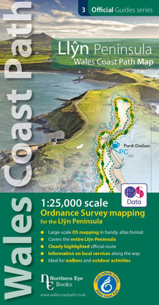
Llyn Peninsula Coast Path Map: 1:25,000 scale Ordnance Survey mapping for the Llyn Peninsula section of the Wales Coast Path by 9781908632609
RRP: $20.98Booksplease Price: $17.72Enhanced, large scale (1: 25,000) Ordnance Survey mapping in a handy atlas format with all the mapping you need to walk the Llyn Peninsula section of the Wales Coast Path. Continuous OS mapping covering the Wales Coast Path between Bangor and...
