Filter By
- Book
- Qty in Cart
- Quantity
- Price
- Subtotal
-

Kennet and Avon Canal: And River Avon by Heron Maps
RRP: €7.13Booksplease Price: €6.49Apologies but we at Booksplease don't have a full description for this book.Book InformationISBN 9781908851376Author Heron MapsFormat PaperbackPage Count 2Imprint Heron MapsPublisher Phoenix Maps -

New York Pop-Up by Dominique Ehrhard
RRP: €23.74Booksplease Price: €17.16A selection of New York s most iconic settings and architectural wonders unfold in seven pop-ups contained in a charming pint-sized package, making it easy to carry along while on tour. Easy to tuck in a bag or a pocket, this book is truly the perfect... -

AA Road Map Wales 9780749584115
RRP: €7.13Booksplease Price: €5.14Fully updated, the maps combine clear design and an easy-to-read scale with more road detail to ensure that you never lose your way. Each map includes information on toll points, service areas, road numbers, motorways, dual carriageways and wide and... -

Pembrokeshire Coast National Park Pocket Map by National Parks UK 9780008439163
RRP: €4.75Booksplease Price: €4.05Handy little full-colour map and guide of Pembrokeshire Coast National Park. Handy little full colour map and guide of Pembrokeshire Coast National Park. This small map with additional text and photographs gives a great overview of... -
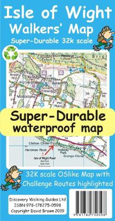
Isle of Wight Walkers Map by David Brawn 9781782750598
RRP: €14.27Booksplease Price: €10.57Isle of Wight Walkers' Map at 32k scale with challenge routes and walking trails highlighted. OS 50k scale mapping is expanded in size to produce a 32k map. The OS features, text and logos are now 50% larger making them much easier to read under outdoor... -

Philip's Compact Britain Road Atlas: (Flexi A5) by Philip's Maps
RRP: €13.08Booksplease Price: €10.14Fully up-to-date in a handy flexibound format, Philip's Compact Britain Road Atlas features the super-clear digital cartography, which was voted Britain's clearest and most detailed mapping in an independent consumer survey.All of Great Britain in a... -

Middlesbrough and Hartlepool by Ordnance Survey 9780755814060
Booksplease Price: €3.76Apologies but we at Booksplease don't have a full description for this book.Book InformationISBN 9780755814060Author Ordnance SurveyImprint Outstanding UK LimitedPublisher Outstanding UK Limited -
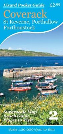
Coverack: St Keverne, Porthallow, Porthoustock by Friendly Guides 9781904645559
RRP: €3.56Booksplease Price: €3.28Apologies but we at Booksplease don't have a full description for this book.Book InformationISBN 9781904645559Author Friendly GuidesImprint Friendly GuidesPublisher Friendly GuidesWeight(grams) 30g -

Botswana, road map 1:1,100,000 9783707921977
RRP: €15.35Booksplease Price: €13.19freytag & berndt car maps are available for many countries and regions worldwide. In addition to the clear design, the street maps have a lot of additional information such as street conditions, sights, campsites and various city center maps. The... -
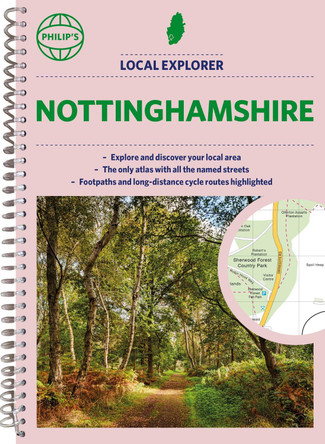
Philip's Local Explorer Street Atlas Nottinghamshire by Philip's Maps 9781849076425
RRP: €20.22Booksplease Price: €15.14Philip's created this new series for walkers, cyclists and local explorers at a scale that provides greener options to uncover all the nature and hidden gems in your local area. From Beeston to Tickwell, we cover Nottinghamshire in enticing detail.Who... -

Northumberland Park Rangers Favourite Walks by National Parks UK
RRP: €8.32Booksplease Price: €6.13The perfect companions for exploring the National Parks. Walking guide to the Northumberland National Park, with 20 best routes chosen by the park rangers. Each walk varies in length from 2 to 10 km and can be completed in less than 4 hours. ... -

Gulf of Naples - Ischia, Capri, Amalfi: 2017 by 9783707901771
RRP: €15.46Booksplease Price: €13.26This recto / verso detailed road map of Gulf of Naples is very suitable for planning and traveling around the country. The road network is well represented, both the main roads, provincial and local roads. Road numbers are also clearly stated. Distances... -

Hadrian's Wall Path by Gordon Simm
Booksplease Price: €12.44?Hadrians Wall Path runs for 86 miles from Bowness-on-Solway to Wallsend along the line of the Roman Wall completed in AD122 under the Emperor Hadrian. This National Trail crosses northern England from Irish Sea to North Sea and offers many chances to... -

Cape Town & Peninsula, South Africa: Travel Maps International Adventure Map by National Geographic Maps 9781566951654
RRP: €17.79Booksplease Price: €15.11AdventureMaps provide global travellers with the perfect combination of detail and perspective, highlighting hundreds of points of interest and the diverse and unique destinations within the country. Each map is printed on durable synthetic paper, making... -

South Pennines by Neil Coates 9780319090046
RRP: €15.46Booksplease Price: €11.35Pathfinder are Britain's best-loved walking guides. Enjoy 28 circular walks around the beautiful South Pennines, with Pathfinder, enjoy the stunning scenery with: Easy to follow directions Route highlights from the best view to great pubs Tried and... -

Walking in the Fowey Area by Liz Hurley
RRP: €10.70Booksplease Price: €9.97Apologies but we at Booksplease don't have a full description for this book.Book InformationISBN 9780993218040Author Liz HurleyFormat PaperbackPage Count 98Imprint Mudlark's PressPublisher Mudlark's PressDimensions(mm) 210mm * 148mm * 7mm -
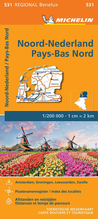
Netherlands North - Michelin Regional Map 531 by Michelin 9782067183360
RRP: €8.32Booksplease Price: €5.63(Edition updated in 2023) MICHELIN Netherlands North Regional Map scale 1/200,000 will provide you with an extensive coverage of primary, secondary and scenic routes for this region. In addition to Michelin's clear and accurate mapping, this regional map... -

Isle of Anglesey Coast Path Map: 1:25,000 scale Ordnance Survey mapping for the entire Isle of Anglesey Coast Path by 9781908632593
RRP: €11.89Booksplease Price: €10.04Enhanced, large scale (1: 25,000) Ordnance Survey mapping in a handy atlas format with all the mapping you need to walk a complete circuit of the Anglesey section of the Wales Coast Path. Continuous OS mapping covering the complete circuit from Menai... -

La Palma Tour & Trail Super-Durable Map by David Brawn 9781782750659
Booksplease Price: €12.03For the best adventures, use the best map. Water-proof, split-proof, tear-proof, adventure-proof. La Palma Tour & Trail Super-Durable Map 7th edition is simply the toughest, most accurate, easy to read, easy to use map of the island you can buy at any... -

Transylvania lam. 9788361155850
Booksplease Price: €11.10Apologies but we at Booksplease don't have a full description for this book.Book InformationISBN 9788361155850Page Count 1Imprint terraQuestPublisher terraQuestWeight(grams) 130g -

France Essential 2024 Tourist & Motoring Atlas by Michelin 9782067261303
RRP: €14.27Booksplease Price: €9.85Michelin's France paperback A4 atlas offers, in addition of Michelin's clear and accurate mapping, an enhanced view of your journey thanks to its scale 1/200,000. The route planner as well as the time distance charts will help you plan and optimise... -

Falkland Islands Explorer: Visitors Map of the Falklands Islands Including Stanley Town Plan by Nigel Sitwell 9780954371746
RRP: €9.51Booksplease Price: €8.75Apologies but we at Booksplease don't have a full description for this book.Book InformationISBN 9780954371746Author Nigel SitwellImprint Ocean Explorer MapsPublisher Ocean Explorer Maps -

National Park Triglav - Kranjska Gora - Planica - Bled Hiking + Leisure Map 1:35 000 9783707904949
RRP: €15.35Booksplease Price: €10.70freytag & berndt maps are available for many countries and regions in the world. In addition to the precise cartography each map also includes a lot of additional information about the region covered.Book InformationISBN 9783707904949Imprint... -

DK Eyewitness Top 10 European Cities by DK Travel 9780241396858
RRP: €17.84Booksplease Price: €16.18An unbeatable, pocket-sized guide to Europe, packed with insider tips and ideas, colour maps, top 10 lists, and a laminated pull-out transport map - all designed to help you experience the very best of Europe's greatest cities - Paris, London, Amsterdam,... -

2025 Philip's Easy to Read Multiscale Road Atlas of Europe: (A4 paperback with flaps) by Philip's Maps 9781849076593
RRP: €17.84Booksplease Price: €12.55PHILIP'S: THE BEST-SELLING EUROPEAN ATLAS RANGE IN THE UKWith the detail you need at a size you can read, the latest 2025 Philip's Easy to Read Multiscale Road Atlas of Europe is the ultimate driving companion. Including the rules and regulations across... -

Norway South, Road and Leisure Map 9783707921601
RRP: €15.46Booksplease Price: €13.15freytag & berndt car maps are available for many countries and regions worldwide. In addition to the clear design, the "Norway South" road map (Oslo - Bergen - Stavanger) has a lot of additional information such as road conditions, sights, campsites and... -

OS Short Walks Made Easy - The Chilterns: 10 Leisurely Walks: 2023 9780319092620
RRP: €8.32Booksplease Price: €6.52Apologies but we at Booksplease don't have a full description for this book.Book InformationISBN 9780319092620Format PaperbackImprint Ordnance SurveyPublisher Ordnance Survey -

South Downs National Park Rangers Favourite Walks by National Parks UK
RRP: €8.32Booksplease Price: €6.13Walking guide to the South Downs National Park, with 20 best routes chosen by the park rangers. Each walk varies in length from 2 to 10 km and can be completed in less than 4 hours. 20 best routes chosen and written by National Park rangers ... -
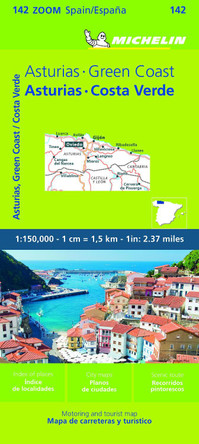
Asturias, Costa Verde - Zoom Map 142 by Michelin 9782067258860
RRP: €8.32Booksplease Price: €6.27(Edition updated in 2023) MICHELIN zoom map Asturias, Costa Verde is the ideal travel companion to fully explore this destination thanks to its easy-to-use format and its scale of 1/150,000. The Zoom collection are characterized by the high precision... -

The Alps - Skiing by Train by 9781858797298
Booksplease Price: €4.70Apologies but we at Booksplease don't have a full description for this book.Book InformationISBN 9781858797298Page Count 1Imprint 2theAlps LtdPublisher Heritage House (Publishers) Ltd -

Moon Memphis (Second Edition) by Margaret Littman
RRP: €14.27Booksplease Price: €10.06From legendary barbecue to famous blues, soak up the best of Bluff City with Moon Memphis. *See the Sites: Immerse yourself in history at the National Civil Rights Museum or the Stax Museum of American Soul Music. Pay respects to the King at Graceland,... -

Philip's Navigator Street Atlas Oxfordshire: Spiral edition by Philip's Maps
RRP: €20.22Booksplease Price: €15.14The only county Street Atlas with all the named streets of Oxfordshire and perfect back-up for emergency services, delivery drivers, visitors and locals.With more than 11,000 named streets, roads, lanes and alleys, this is the essential map book for... -

Nottingham Pocket Street Map by A-Z maps
RRP: €4.75Booksplease Price: €4.05Navigate your way around Nottingham with detailed street maps from A-Z This up-to-date, folded A-Z street map includes all of the 1,500 streets in and around Nottingham.As well as Nottingham Castle and Lace Market, the other areas covered... -

The Great Trossachs Path Xt40: And the Great Trossachs Forest by Harvey Map Services Ltd.
Booksplease Price: €10.78The Great Trossachs Path and Great Trossachs Forest is a 30 mile (48km) long distance path from Callander to Inversnaid linking together three of Scotland's Great Trails : the West Highland Way, the Rob Roy Way and the Three Lochs Way. It is therefore a... -

Dartmoor for Cyclists: For off-Road Cycling and Cycle Touring by Harvey Map Services Ltd. 9781851374540
Booksplease Price: €17.37Two-in-one cycling map of Dartmoor, one side for mounting biking, one side for cycle touring, this tough, durable, waterproof map of Dartmoor and the surrounding area is purpose-made for the outdoors. Made in cooperation with Dartmoor National Park... -

Dublin Like a Local: By the People Who Call It Home by DK Eyewitness
RRP: €15.46Booksplease Price: €9.69Keen to explore a different side of Dublin? Like a Local is the book for you.This isn't your ordinary travel guide. You won't find Temple Bar and Trinity College in these pages, because that's not where Dubliner's hang out. Instead, you'll meet the... -

Galloway Hills: XT25 by 9781851376070
Booksplease Price: €16.41The Galloway Hills form part of the Southern Uplands of Scotland. This map for hillwalkers covers Glen Trool and Loch Dee north to Loch Doon and Carrick Forest. It covers a large part of the popular Galloway Forest Park. The Minnigaff Hills, Merrick,... -

Paddling Map of Britain - Third Edition 2022 by Peter Knowles
Booksplease Price: €11.98This map of mainland Britain that shows the huge extent of paddling possibilities on rivers, lochs, canals and coast - some 37,000km of paddling! Enthusiasts buy this map to plan and dream, whilst for the newcomer to the sport it answers that... -

Dartmoor National Park Pocket Map by National Parks UK 9780008439194
RRP: €4.75Booksplease Price: €3.97Handy little full-colour map and guide of Dartmoor National Park. Detailed mapping and visitor information to the National Park along with a selection of photographs. Map at a scale of 1:105,000 (1.68 miles to 1 inch or 1.05 km to 1cm). ... -
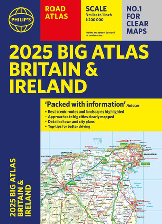
2025 Philip's Big Road Atlas of Britain & Ireland: (A3 Paperback) by Philip's Maps 9781849076630
RRP: €17.84Booksplease Price: €12.55'Good balance between detail and clarity with excellent town maps' What Car?PHILIP'S is No. 1 in the UK for clear maps. The latest 2025 Philip's Big Road Atlas of Britain and Ireland, in a supersize large format, has fully updated maps from the Philip's...
