Filter By
- Book
- Qty in Cart
- Quantity
- Price
- Subtotal
-

TERRA- 1: Understanding The Terrestrial Environment: The Role of Earth Observations from Space by Paul Mather 9780367579951
RRP: £48.99Booksplease Price: £43.61This text aims to offer information on research approaches to assessing global environment changes. It includes suggestions for the exchange of ideas between those studying land surface and remote sensing specialists, and advocates synthesizing the... -
Deep Learning for Remote Sensing Images with Open Source Software by Rémi Cresson 9780367858483
RRP: £89.99Booksplease Price: £78.17In today's world, deep learning source codes and a plethora of open access geospatial images are readily available and easily accessible. However, most people are missing the educational tools to make use of this resource. Deep Learning for Remote... -

Atmospheric Acoustic Remote Sensing: Principles and Applications by Stuart Bradley 9780367577551
RRP: £48.99Booksplease Price: £43.61Sonic Detection and Ranging (SODAR) systems and Radio Acoustic Sounding Systems (RASS) use sound waves to determine wind speed, wind direction, and turbulent character of the atmosphere. They are increasingly used for environmental and scientific... -

3D Cadastre in an International Context: Legal, Organizational, and Technological Aspects by Jantien E. Stoter 9780367577896
RRP: £48.99Booksplease Price: £43.91The increase in private property value, growth of underground and multilevel development, and the emergence of 3D technologies in planning and GIS drives the need to record 3D situations in cadastral registration. 3D Cadastre in an International Context:... -

Object-Oriented Design for Temporal GIS by Monica Wachowicz 9780367579173
RRP: £48.99Booksplease Price: £43.61There has been an increasing demand in GIS for systems that support historical data: time-series data as well as mobility information. From a modelling perspective, there are advantages in integrating object-oriented analysis and design to databases as... -

Principles of Modeling Uncertainties in Spatial Data and Spatial Analyses by Wenzhong Shi 9780367577247
RRP: £48.99Booksplease Price: £43.91When compared to classical sciences such as math, with roots in prehistory, and physics, with roots in antiquity, geographical information science (GISci) is the new kid on the block. Its theoretical foundations are therefore still developing and data... -
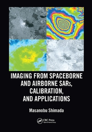
Imaging from Spaceborne and Airborne SARs, Calibration, and Applications Masanobu Shimada 9780367570798
RRP: £48.99Booksplease Price: £43.91Sixty years after its birth, Synthetic Aperture Radar (SAR) evolved as a key player of earth observation, and it is continually upgraded by enhanced hardware functionality and improved overall performance in response to user requirements. The basic... -

Spatial Thinking in Environmental Contexts: Maps, Archives, and Timelines Sandra Lach Arlinghaus (University of Michigan, Ann Arbor, Michigan, USA) 9781138747319
RRP: £47.99Booksplease Price: £42.76Spatial Thinking in Environmental Contexts: Maps, Archives, and Timelines cultivates the spatial thinking "habit of mind" as a critical geographical view of how the world works, including how environmental systems function, and how we can approach and... -

Polarimetric SAR Imaging: Theory and Applications by Yoshio Yamaguchi 9780367503109
RRP: £53.99Booksplease Price: £47.82Radar polarimetry has been highly sought after for its use in the precise monitoring of Earth's surface. Polarimetric SAR Imaging explains the basic concepts of polarimetry and its diverse applications including: deforestation, tree classification,... -

Geospatial Information Handbook for Water Resources and Watershed Management, Volume I: Fundamentals and Analyses by John G Lyon 9781032006369
RRP: £120.00Booksplease Price: £105.30Volume I of Geospatial Information Handbook for Water Resources and Watershed Management discusses fundamental characteristics, measurements, and analyses of water features and watersheds including lakes and reservoirs, rivers and streams, and coasts and... -

Remote Sensing with Polarimetric Radar by Harold Mott 9780470074763
RRP: £142.95Booksplease Price: £125.11Discover the principles and techniques of remote sensing with polarimetric radar This book presents the principles central to understanding polarized wave transmission, scattering, and reception in communication systems and polarimetric and... -

Spatial Technology and Archaeology: The Archaeological Applications of GIS David Wheatley (University of Southampton, UK) 9780415246392
RRP: £130.00Booksplease Price: £114.10Geographical Information Systems (GIS) and related spatial technologies have a new and powerful role to play in archaeological interpretation. Beginning with a conceptual approach to the representation of space adopted by GIS, this book examines spatial... -

Earth observation science and applications for risk reduction and enhanced resilience in Hindu Kush Himalaya Region: A decade of experience from SERVIR by Birendra Bajracharya 9783030735685
RRP: £44.99Booksplease Price: £26.16This open access book is a consolidation of lessons learnt and experiences gathered from our efforts to utilise Earth observation (EO) science and applications to address environmental challenges in the Hindu Kush Himalayan region. It includes a complete... -

Socio-Economic Applications of Geographic Information Science by David Kidner
RRP: £48.99Booksplease Price: £43.61To date, no one volume in the Innovations in GIS series has been given over to solely highlighting the use of up-to-date GIS-based techniques in a range of socio-economic applications. This monograph redresses this gap. The book begins with a short... -

Spatial Decision Support Systems: Principles and Practices by Ramanathan Sugumaran
RRP: £57.99Booksplease Price: £51.19Although interest in Spatial Decision Support Systems (SDSS) continues to grow rapidly in a wide range of disciplines, students, planners, managers, and the research community have lacked a book that covers the fundamentals of SDSS along with the... -

Land Reclamation and Restoration Strategies for Sustainable Development: Geospatial Technology Based Approach: Volume 10 by Gouri Sankar Bhunia
RRP: £115.00Booksplease Price: £104.37Land Reclamation and Restoration Strategies for Sustainable Development: Geospatial Technology Based Approach, Volume Ten covers spatial mapping, modeling and risk assessment in land hazards issues and sustainable management. Each section in the book... -

Urban Remote Sensing by Qihao Weng
RRP: £48.99Booksplease Price: £43.61Urban Remote Sensing, Second Edition assembles a team of professional experts to provide a much-needed update on the applications of remote sensing technology to urban and suburban areas. This book reflects new developments in spaceborne and airborne... -

Geographic Data Science with Python by Sergio Rey
RRP: £135.00Booksplease Price: £118.05This book provides the tools, the methods, and the theory to meet the challenges of contemporary data science applied to geographic problems and data. In the new world of pervasive, large, frequent, and rapid data, there are new opportunities to... -

Satellite Interferometry Data Interpretation and Exploitation: Case Studies from the European Ground Motion Service (EGMS) by Michele Crosetto
RRP: £138.00Booksplease Price: £124.62Satellite Interferometry Data Interpretation and Exploitation: Case Studies from the European Ground Motion Service (EGMS) focuses on the interpretation and exploitation of data obtained from InSAR, thus enabling millimeter-scale deformation measurements... -

Urban Remote Sensing by Xiaojun X. Yang
RRP: £126.95Booksplease Price: £112.02Urban Remote Sensing The second edition of Urban Remote Sensing is a state-of-the-art review of the latest progress in the subject. The text examines how evolving innovations in remote sensing allow to deliver the critical information on cities in a... -

Earth Observation, Public Health and One Health: Activities, Challenges and Opportunities by Dr Stephanie Brazeau
RRP: £103.75Booksplease Price: £98.69This book focuses on the potential for Earth Observation (EO) to contribute to public health practice. Remote sensing experts from the EO community together with epidemiologists, modelling experts, policy makers, managers and public health researchers... -

Artificial Intelligence in Digital Holographic Imaging: Technical Basis and Biomedical Applications by Inkyu Moon
RRP: £121.00Booksplease Price: £106.45Artificial Intelligence in Digital Holographic Imaging Technical Basis and Biomedical Applications An eye-opening discussion of 3D optical sensing, imaging, analysis, and pattern recognition Artificial intelligence (AI) has made great progress in recent... -

Innovations in GIS 6: Integrating Information Infrastructures with GI Technology by Bruce Gittings
RRP: £48.99Booksplease Price: £43.61Integrating Information with GI Technology examines the components necessary for building infrastructure to support the panoly of Geographic Information (GI) research and services. These include novel approaches to two- and three-dimensional spatial... -

Remote Sensing and Cognition: Human Factors in Image Interpretation by Raechel A. White
RRP: £48.99Booksplease Price: £43.61Human factors play a critical role in the design and interpretation of remotely sensed imagery for all Earth sciences. Remote Sensing and Cognition: Human Factors in Image Interpretation brings together current topics widely recognized and addressed... -

Spatial Information for Land Use Management by Michael J. Hill
RRP: £48.99Booksplease Price: £43.61Geographic Information Systems (GIS), Remote Sensing, and environmental modelling are increasingly being used to address land use and land use management issues although much of the development in these applications is based in specific case studies that... -
Subpixel Mapping for Remote Sensing Images by Peng Wang
RRP: £120.00Booksplease Price: £105.30Subpixel mapping is a technology that generates a fine resolution land cover map from coarse resolution fractional images by predicting the spatial locations of different land cover classes at the subpixel scale. This book provides readers with a... -

International Study on Cost-Effective Earth Observation Missions by Rainer Sandau
RRP: £69.99Booksplease Price: £61.31It is within the means of many nations to conduct or participate in cost-effective Earth observation missions. This study provides a definition of cost-effective Earth observation missions and information about background material and organizational... -

Post-Launch Calibration of Satellite Sensors: Proceedings of the International Workshop on Radiometric and Geometric Calibration, December 2003, Mississippi, USA. by Stanley A. Morain
RRP: £130.00Booksplease Price: £113.80Increasingly, in the field of earth observation imagery, there is a need for image quality to be assessable in traceable Standard International Units (SIU), and for the standardization of common mapping projections. These two needs, plus the increased... -
Multisensor Data Fusion and Machine Learning for Environmental Remote Sensing by Ni-Bin Chang
RRP: £48.99Booksplease Price: £44.41In the last few years the scientific community has realized that obtaining a better understanding of interactions between natural systems and the man-made environment across different scales demands more research efforts in remote sensing. An integrated... -

Mapping Community Health: GIS for Health and Human Services by Christopher Thomas
RRP: £17.99Booksplease Price: £17.35Discover a modern approach to help build healthier communities. Improving health outcomes, increasing access to health care, and building healthier communities requires a modern approach to understanding health and human service issues that are more... -

Foundations of Geographic Information Science by Matt Duckham
RRP: £130.00Booksplease Price: £113.80As the use of geographical information systems develops apace, a significant strand of research activity is being directed to the fundamental nature of geographic information. This volume contains a collection of essays and discussions on this theme. ... -

Thematic Cartography and Geovisualization, Fourth Edition by Terry A Slocum
RRP: £145.00Booksplease Price: £128.95This comprehensive and well-established cartography textbook covers the theory and the practical applications of map design and the appropriate use of map elements. It explains the basic methods for visualizing and analyzing spatial data and introduces... -

Remote Sensing Data Analysis in R by Alka Rani
RRP: £97.99Booksplease Price: £85.22Remote Sensing Data Analysis in R is a guide book containing codes for most of the operations which are being performed for analysing any satellite data for deriving meaningful information. The goal of this book is to provide hands on experience in... -

GIS for Environmental Decision-Making by Andrew A. Lovett
RRP: £145.00Booksplease Price: £126.55Environmental applications have long been a core use of GIS. However, the effectiveness of GIS-based methods depends on the decision-making frameworks and contexts within which they are employed. GIS for Environmental Decision-Making takes an... -
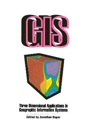
Three Dimensional Applications In GIS by Jonathan Raper
RRP: £56.99Booksplease Price: £50.36Provides a survey of the approaches used and the problems encountered in the model of real geophysical data.About the AuthorRaper, JonathanBook InformationISBN 9780850667769Author Jonathan RaperFormat HardbackPage Count 280Imprint Taylor & Francis... -
GIS In Organizations: How Effective Are GIS In Practice? by Ian Masser
RRP: £110.00Booksplease Price: £95.06In placing these questions at the heart of their book, the authors set out to stimulate and contribute to the great debate: despite the enormous growth in the acquistion of GIS technology by business and government, little is known about the impact this... -

Advances in Geo-Spatial Information Science by Wenzhong Shi
RRP: £56.99Booksplease Price: £50.66Advances in Geo-Spatial Information Science presents recent advances regarding fundamental issues of geo-spatial information science (space and time, spatial analysis, uncertainty modeling and geo-visualization), and new scientific and technological... -

Small-Scale Map Projection Design by Frank Canters
RRP: £130.00Booksplease Price: £114.10The use of computers in cartography has made it a lot easier for map makers to transform data from one map projection to another and experiment with alternative representations of geographical data. Yet this has also created new challenges and... -

Basic GIS Coordinates by Jan Van Sickle
RRP: £145.00Booksplease Price: £126.55Coordinates are integral building tools for GIS, cartography, surveying and are vital to the many applications we use today such as smart phones, car navigation systems and driverless cars. Basic GIS Coordinates, Third Edition grants readers with a solid... -
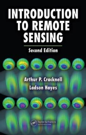
Introduction to Remote Sensing by Arthur P. Cracknell
RRP: £100.00Booksplease Price: £86.92Addressing the need for updated information in remote sensing, Introduction to Remote Sensing, Second Edition provides a full and authoritative introduction for scientists who need to know the scope, potential, and limitations in the field. The authors...
