Filter By
- Book
- Qty in Cart
- Quantity
- Price
- Subtotal
-

Loch Lomond & The Trossachs by 9781851376254
Booksplease Price: $21.65The Ultramap covers a large area yet is small enough to slip in a pocket.It is a fully detailed genuine original HARVEY map. The Ultramap is tough, light and 100% waterproof. To provide the biggest area on the smallest lightest sheet, the Ultramap is... -

Moon New York City (First Edition) by Christopher Kompanek
RRP: $29.38Booksplease Price: $20.27From the corner bodega to the top of the Empire State Building, NYC is overflowing with energy and culture. Experience the city with a local with Moon New York City.Explore the City: Navigate by neighborhood or by activity with color-coded maps, or... -

Eure-et-Loir, Paris, Yvelines - Michelin Local Map 311 by 9782067202139
RRP: $12.58Booksplease Price: $10.04(Edition revised in 2022) The MICHELIN Eure-et-Loir, Paris, Yvelines local map, scale 1/150,000 is the ideal companion to fully explore Paris surrounding areas and provides star-rated Michelin tourist itineraries and attractions, as well as impressive 3D... -

Lough Neagh by Land and Property Services 9781905306657
Booksplease Price: $19.82Apologies but we at Booksplease don't have a full description for this book.Book InformationISBN 9781905306657Author Land and Property ServicesImprint Land & Property ServicesPublisher Land & Property Services -

Yorkshire - North Sea: Map 3: East by 9780953227792
Booksplease Price: $15.23Apologies but we at Booksplease don't have a full description for this book.Book InformationISBN 9780953227792Imprint Trans Pennine Trail ProjectPublisher Trans Pennine Trail Project -

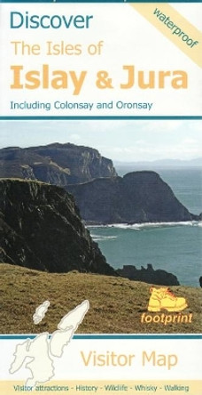
Discover The Isles of Islay and Jura: Including Colonsay and Oransay by Stirling Surveys 9781871149968
Booksplease Price: $19.03- Visitor map of Islay, Jura and Colonsay - New clear mapping, based on OS data, at a scale of 1:90000 - Waterproof paper and compact pocket size - Excellent value for money - ideal for touring the islandsBook InformationISBN 9781871149968Author... -

Fort William, Glencoe, and Lochaber 9780319092781
Booksplease Price: $16.61Each walk features a simple-to-follow route profile and accompanying description and pictures, and new-look walk mapping that makes it easier for the user to focus on the route and the points of interest along the way.Book InformationISBN... -

Kalimnos: 2009 by 9789608195943
Booksplease Price: $17.45Waterproof and tear resistant. Trails marked and illustrated with picturesBook InformationISBN 9789608195943Page Count 1Imprint AnavasiPublisher Anavasi -

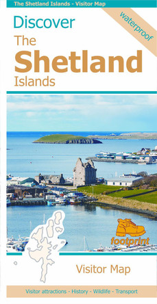
The Shetland Islands: Visitor Map by Footprint maps 9781871149920
Booksplease Price: $19.03This map is the perfect companion to take for exploring the Shetland Islands. It is packed with lots of information on where to find the best that this group of islands has to offer visitors. There is a wide range of wild landscapes: from magnificent... -

Lake District Outdoor Atlas 9781851374908
Booksplease Price: $19.03Revised Edition. The Atlas combines in one volume detailed mapping of the whole of the Lake District National Park. The cover is laminated, the pages are printed on latex impregnated paper, making the whole atlas waterproof. If your Outdoor Atlas gets... -

Oxford: Mapping the City by Daniel MacCannell
Booksplease Price: $70.37Over the past four and a half centuries, the magnificent city of Oxford has been mapped for many reasons, few of which have involved the mere finding of one's way through the streets. Maps were produced as part of schemes to defend Oxford from rampaging... -

South America: 2019 by 9781771297110
Booksplease Price: $23.31Apologies but we at Booksplease don't have a full description for this book.Book InformationISBN 9781771297110Page Count 1Imprint ITMB PublishingPublisher ITMB PublishingWeight(grams) 130g -

Imray 2200 Chart Pack: The Solent: 2024 by Imray 9781786795656
Booksplease Price: $112.77This fully revised and extended edition of our popular Solent chart pack has been redesigned and expanded to 16 sheets. It includes the latest official UKHO data combined with additional information sourced from Imray's network to make it ideal for small... -

Mullion: Goonhilly, Predannack, Poldhu, Gunwalloe by Friendly Guides 9781904645573
RRP: $6.28Booksplease Price: $5.80Apologies but we at Booksplease don't have a full description for this book.Book InformationISBN 9781904645573Author Friendly GuidesImprint Friendly GuidesPublisher Friendly Guides -

East Dulwich 1894: London Sheet 117.2 by Stephen Humphrey 9781841518824
Booksplease Price: $8.32Apologies but we at Booksplease don't have a full description for this book.Book InformationISBN 9781841518824Author Stephen HumphreyImprint Alan Godfrey MapsPublisher Alan Godfrey Maps -

Jersey Official Leisure Map by States of Jersey 9780955934131
Booksplease Price: $23.63Apologies but we at Booksplease don't have a full description for this book.Book InformationISBN 9780955934131Author States of JerseyFormat PaperbackImprint DigimapPublisher Digimap -

Picos De Europa - Macizos Central y Oriental by 9788493317782
Booksplease Price: $24.49Detailed 1:25,000 map of the central and Eastern part of Picos De Europa, showing topography and hiking trails through the region. On the reverse is a drawn representation of the area. There is a full English language key as well.Book InformationISBN... -

Nicolson Street Atlas Dumfries and Galloway by 9781912046690
RRP: $16.78Booksplease Price: $12.20Based on OS data and fully revised for 2017 the new Dumfries & Galloway Street Atlas is your essential guide to the towns and villages throughout Dumfries & Galloway. Exceptionally clear mapping and full index to street names. Don't leave home without... -

St Martin's: Eastern Isles by Friendly Guides 9781904645191
RRP: $6.28Booksplease Price: $5.80Apologies but we at Booksplease don't have a full description for this book.Book InformationISBN 9781904645191Author Friendly GuidesImprint Friendly GuidesPublisher Friendly Guides -

Aigina: 2014 by 9789609412858
Booksplease Price: $14.26Apologies but we at Booksplease don't have a full description for this book.Book InformationISBN 9789609412858Page Count 1Imprint AnavasiPublisher Anavasi -

terraQuest Trekking Map Rila and Piryn by terraQuest
Booksplease Price: $31.16Apologies but we at Booksplease don't have a full description for this book.Book InformationISBN 9788361155591Author terraQuestImprint terraQuestPublisher terraQuest -

London Flipped Charlie Peel 9781914432170
RRP: $31.48Booksplease Price: $21.53The first full-size map of London drawn upside-down - this map surprises even those most familiar with the capital's cartography. It is a true, topographical map covering the whole of Greater London and its surroundings, but rotated 180 Degrees. With... -

Croatia Road Map 1:500,000 9783707921861
RRP: $27.09Booksplease Price: $22.89In addition to the clear design, the road map "Croatia 1:500,000" offers a lot of additional information such as sights, campsites and city centre maps. The comprehensive register of places enables quick orientation. Road map of Croatia 1:500,000 ... -

Imray Chart Y18: The River Medway and Approaches: 2024 by Imray 9781786795625
Booksplease Price: $45.971:20 000 WGS 84 Plans included: Whitton Marine (1:6000 ) Chatham Marina (1:10 000) Gillingham Marina (1:10 000) River Medway Continuation (1:25 000) Entrance to the River Medway (1:42 500)About the AuthorImray Laurie Norie & Wilson Ltd was... -

Exmoor 9780319092811
RRP: $18.88Booksplease Price: $14.28Each walk features a simple-to-follow route profile and accompanying description and pictures, and new-look walk mapping that makes it easier for the user to focus on the route and the points of interest along the way.Book InformationISBN... -

North West Iceland Map 1:300 000: 2018 by H H Hansen 9789979338246
Booksplease Price: $46.75Apologies but we at Booksplease don't have a full description for this book.Book InformationISBN 9789979338246Author H H HansenPage Count 2Imprint Mal Og Menning,IcelandPublisher Mal Og Menning,IcelandWeight(grams) 85g -

Silk Road Countries geographical: 2019 9789632041384
Booksplease Price: $28.75Apologies but we at Booksplease don't have a full description for this book.Book InformationISBN 9789632041384Page Count 1Imprint GiziMapPublisher GiziMapWeight(grams) 137g -

Snowdonia Central: Porthmadog, Rhinog Fawr 9781851376803
Booksplease Price: $28.96Snowdonia Central / Porthmadog, Rhinog Fawr Detailed map for hillwalkers of Snowdon. Snowdonia Central includes Rhinog Fawr, Rhinog Fach and Moelwyn Mawr Welsh-English text. Tough, light, durable and 100% waterproof Opens directly to either... -

Italy Road Atlas (1:150,000) Freytag Berndt 9783707921663
RRP: $77.49Booksplease Price: $64.45In addition to the clear design, the large road atlas of Italy has a lot of additional information such as road conditions, sights and various city maps. An extra chapter also deals with all campsites and parking spaces in Italy. The extensive location... -

Slovak Republic Marco Polo Map by Marco Polo 9783575017765
RRP: $20.98Booksplease Price: $15.41Let the Marco Polo Slovak Republic Road Map guide you around this stunning country. Discover picturesque towns, glorious mountains and distinctive castles with this highly durable, detailed touring map of Slovakia. It folds away easily and is always on... -

Cantal, Lozire - Michelin Local Map 330 by Michelin 9782067202320
RRP: $14.68Booksplease Price: $11.07(Edition updated in 2023) The MICHELIN Cantal, Lozire local map, scale 1 / 150 000 is the ideal companion to fully explore the fabulous France local areas and provides star-rated Michelin tourist itineraries and attractions, as well as impressive 3D... -

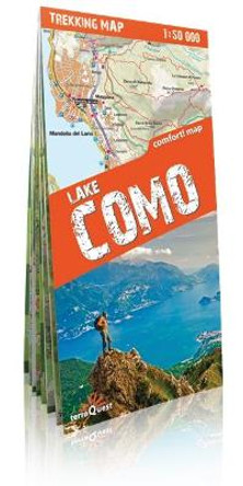
terraQuest Trekking Map Lake Como by terraQuest
Booksplease Price: $31.16Apologies but we at Booksplease don't have a full description for this book.Book InformationISBN 9788361155515Author terraQuestImprint terraQuestPublisher terraQuest -

Folegandros: 2016 by 9789609412551
Booksplease Price: $14.26The map of Folegandros by Anavasi editions in a scale of 1:18 000 depicts with detail the beautiful footpaths of the island with their corresponding signposting. Field work on Folegandros was done during the Spring of 2016. Folegandros is a walking... -

Amorgos: 2017 by 9789608195318
Booksplease Price: $17.45Amorgos Hiking map in scale 1:32 000 is updated with all new footpaths, roads, toponyms and even the diving center. From above, Amorgos looks like a skeletal form whose ravines draw the bones, but as you get closer, the continual variations of the... -

Iceland Touring Map for drivers and tourists 1:600 000: 2019 by H H Hansen
RRP: $41.90Booksplease Price: $40.99Apologies but we at Booksplease don't have a full description for this book.Book InformationISBN 9789979338222Author H H HansenImprint Mal Og Menning,IcelandPublisher Mal Og Menning,IcelandWeight(grams) 88g -

Airline Maps: A Century of Art and Design by Mark Ovenden
RRP: $52.50Booksplease Price: $28.39Apologies but we at Booksplease don't have a full description for this book.Book InformationISBN 9780143134077Author Mark OvendenFormat PaperbackPage Count 144Imprint PlumePublisher Penguin Putnam Inc -

Lee and Stort Navigations: East London Ring and Bow Back Rivers by Heron Maps
RRP: $12.58Booksplease Price: $11.45Apologies but we at Booksplease don't have a full description for this book.Book InformationISBN 9781908851291Author Heron MapsFormat PaperbackPage Count 2Imprint Heron MapsPublisher Phoenix Maps -

Taygetos (8.1) Map & Guides: 1:25,000 scale map and hiking guide by Anavasi
Booksplease Price: $29.86Taygetos extends as 70km of magnificent massif anchoring the southern tip of Greece. From a dense network of challenging trails, Anavasi selected routes favoured since antiquity by devotees of sky-gods or their successor, the Prophet Elijah. Paths... -

Helvellyn and Fairfield: A Hillwalker's Guide and Map by 9781874306085
Booksplease Price: $10.16Apologies but we at Booksplease don't have a full description for this book.Book InformationISBN 9781874306085Imprint Altos Design LtdPublisher Altos Design Ltd -

Eastern England A-Z Road Atlas A-Z Maps 9780008652821
RRP: $16.78Booksplease Price: $12.10A full-colour, regional road atlas from A-Z Maps. Featuring more than 50 pages of continuous mapping of regions in the east of England. Published at a clear 2.5 miles to 1 inch the following features are shown on the road mapping: Motorways with full...
