Filter By
- Book
- Qty in Cart
- Quantity
- Price
- Subtotal
-

The Skye Trail: A challenging backpacking route from Rubha Hunish to Broadford by Helen Webster 9781786311863
RRP: €17.79Booksplease Price: €11.82Guidebook to the Skye Trail, a challenging 80-mile (128km) trek that snakes its way north-south across the Isle of Skye. This unofficial, week-long route is ideal for backpacking, camping wild each night, but can also be walked between overnight... -

The Ridgeway (Trailblazer British Walking Guides): 53 large-scale maps & guides to 24 towns and villages, Avebury to Ivinghoe Beacon and Ivinghoe Beacon to Avebury by Nick Hill
RRP: €15.46Booksplease Price: €12.84All-in-one guide to walking The Ridgeway path, running from Wiltshire to Buckinghamshire, in southern England. New two-way edition with routes rewalked in both directions from Avebury to Ivinghoe Beacon near Aylesbury and Ivinghoe Beacon to Avebury, and... -

North Yorkshire Dog Friendly Pub Walks: 20 Walks in the Yorkshire Dales and North York Moors by Peter Naldrett
RRP: €11.89Booksplease Price: €10.2620 WALKS THAT ARE PERFECT FOR YOUR DOG AND GREAT PUBS WHERE THEY'RE WELCOME! This collection of tried-and-tested walks in North Yorkshire, all between 3 and 81/2 miles, has been written specifically for dogs and their owners, allowing for maximum... -

Walking the Tour of the Lake District: One-two week circuit of Cumbria's fells, valleys and lakes by Lesley Williams
RRP: €20.17Booksplease Price: €13.78The Lake District National Park is England's most popular mountain region and is designated as a UNESCO World Heritage site. Suitable for most reasonably fit hillwalkers, the 145km (90 mile) Tour of the Lake District takes in the best of this beautiful... -

ORKNEY AND SHETLAND by 9780319092088
RRP: €15.46Booksplease Price: €11.35In Orkney, the first walk is a short stroll around Hoxa Head with its extensive views across Scapa Flow and subsequent routes go on to explore more widely over Mainland Orkney and take in the islands of Hoy, Rousay and South Ronaldsay, concluding with a... -

Ben Nevis Ultramap by 9781851375776
Booksplease Price: €12.27HARVEY launch innovative new series: Ultramap XT40. 16 titles featuring in Trail magazine through spring 2016. 40 years experience have gone into HARVEY's most creative new series. The Ultramap covers a large area yet is small enough to slip in a pocket... -

The Earth Beneath My Feet: A 7,000-Mile Walk of Discovery into the Heart of Wild Nature by Andrew Terrill 9781737068600
RRP: €17.79Booksplease Price: €16.36Apologies but we at Booksplease don't have a full description for this book.Book InformationISBN 9781737068600Author Andrew TerrillFormat PaperbackPage Count 378Imprint Enchanted Rock Press, LLCPublisher Enchanted Rock Press, LLCWeight(grams)... -

Via Ferratas of the Italian Dolomites: Vol 2: Southern Dolomites, Brenta and Lake Garda by Graham Fletcher 9781852843809
RRP: €22.55Booksplease Price: €15.21Guidebook to the via ferrata routes of the southern Italian Dolomites. This guide covers via ferrata routes in the major mountain ranges of Civetta, Schiara and Pala as well as those to the west in the Brenta. A significant addition (and, as far as we... -

Somerset Dog Friendly Pub Walks: 20 Dog Walks by Paul Boobyer 9781846743849
RRP: €10.70Booksplease Price: €9.3420 tried-and-tested circular walks in Somerset, all between 11/2 and 7 miles, written specifically for dogs and owners, allowing for maximum off-lead time. At the heart of every route is a dog-friendly pub. Highlights include: Spectacular views and... -

Outer Hebrides 9780319092552
RRP: €15.46Booksplease Price: €11.35Apologies but we at Booksplease don't have a full description for this book.Book InformationISBN 9780319092552Format PaperbackImprint Pathfinder GuidesPublisher Crimson Publishing -

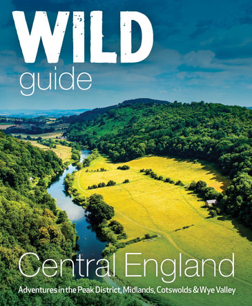
Wild Guide Central England: Adventures in the Peak District, Cotswolds, Midlands, Wye Valley, Welsh Marches and Lincolnshire Coast by Nikki Squires 9781910636206
RRP: €20.22Booksplease Price: €14.29With comprehensive coverage of: Derbyshire, Staffordshire, Nottinghamshire, Leicestershire, Warwickshire, Worcestershire, Shropshire, Herefordshire, Monmouthshire, Gloucestershire, North Oxfordshire, Rutland and Lincolnshire. A new compendium of... -

Northumberland: 2023 9780319092576
RRP: €15.46Booksplease Price: €11.35Apologies but we at Booksplease don't have a full description for this book.Book InformationISBN 9780319092576Format PaperbackImprint Pathfinder GuidesPublisher Crimson Publishing -

Eryri/Snowdonia: 40 Favourite Walks Tom Hutton 9781916739031
Booksplease Price: €7.60A beguiling mix of towering mountains, knife-edge ridges, wild river gorges and glorious beaches attracts thousands of visitors every year to the celebrated upland landscape of Eryri (Snowdonia) in North Wales. Rich in folklore and mythology and full of... -

CAMBRIDGESHIRE & THE FENS: 2017 by 9780319090794
RRP: €15.46Booksplease Price: €11.35Often dismissed as flat and featureless, the waterlands of East Anglia offer great, and largely undiscovered, opportunities for any walker. With the tranquil riverside scenery, charming towns, villages and country houses, and the mesmerising beauty of... -

Isle of Anglesey - Top 10 Walks: Circular walks along the Wales Coast Path by Carl Rogers
Booksplease Price: €7.60These attractive and cleverley structured guidebooks give walkers the ten finest circualr routes on a section of the Wales Coast Path in a popular pocketable format. With clear information, an overview and introduction for each walk, expertly... -

Cumbria Way XT40 by Harvey Map Services Ltd. 9781851374243
Booksplease Price: €16.84Entire route on one map The Cumbria Way is 112km (70 miles) from Ulverston to Carlisle. It passes through Coniston, Dungeon Ghyll, Keswick and Caldbeck. The route passes mostly through valleys rather than over high tops. Tough, light, durable... -

Walking in the Peak District - White Peak West: 40 walks in the hills of Cheshire, Derbyshire and Staffordshire by Paul Besley
RRP: €15.41Booksplease Price: €10.59A guidebook to 40 day walks exploring the western White Peak in the Peak District National Park. Covering Derbyshire, Cheshire and Staffordshire, the walks are suitable for beginner and experienced walkers alike.The walks range in length from 6-24km... -

Day Walks in the Cairngorms: 20 circular routes in the Scottish Highlands by Helen Webster 9781912560639
Booksplease Price: €13.38Day Walks in the Cairngorms features 20 circular routes between 6.3 and 18.4 miles (10.2km and 29.6km) in length, spread across the Cairngorms National Park. Researched and written by local and experienced authors Helen and Paul Webster, founders of the... -

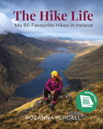
The Hike Life: My 50 Favourite Hikes in Ireland - IBA Lifestyle Book of the Year Rozanna Purcell 9781785303982
RRP: €23.80Booksplease Price: €15.54Fall in love with Ireland's dramatic mountains and rugged coastline in 50 unforgettable hikes.Roz Purcell has been hiking the length and breadth of Ireland for years with her enthusiastic community The Hike Life, exploring the best of what the island has... -

Walking in the Bavarian Alps: 70 mountain walks and treks in southern Germany by Grant Bourne 9781852849290
RRP: €22.55Booksplease Price: €13.08A guidebook to 70 graded walks and treks in Germany's Bavarian Alps. Exploring the beautiful scenery of the German-Austrian border between Lake Constance and Berchtesgaden, the routes are suitable for all abilities and are perfect for walking April... -

NORTH AND MID DEVON: 2017 by 9780319090756
RRP: €15.46Booksplease Price: €11.35Are you planning a visit or holiday to North or Mid Devon? Do you enjoy a walk in the country or a leisurely afternoon stroll? Inside Pathfinder(R) Guide to North and Mid Devon are 28 fantastic country walks designed for walkers of all abilities. Ranging... -

AA 50 Walks in Brecon Beacons & South Wales 9780749583705
RRP: €16.65Booksplease Price: €10.48The books feature all the practical detail you need, accompanied by fascinating background reading on the history and wildlife of the area, and clear mapping for ease of use. Every route has been colour coded according to difficulty. All walks are... -

Walking Ben Lawers, Rannoch and Atholl: Mountains and glens of Highland Perthshire by Ronald Turnbull
RRP: €17.79Booksplease Price: €11.82A guidebook to 80 walks in the highlands of Perthshire. Exploring the beautiful scenery of Scotland's south-eastern Grampians, the walks are suitable for most walkers, with shorter routes alongside plenty of more challenging, full-day hikes.The walks... -

Epic Hikes of the World by Lonely Planet
RRP: €29.74Booksplease Price: €24.18With stories of 50 incredible hiking routes in 30 countries, from New Zealand to Peru, plus a further 150 suggestions, Lonely Planet's Epic Hikes of the World will inspire a lifetime of adventure on foot. From one-day jaunts and urban trails to... -

100 Walks in Yorkshire: North York Moors and Wolds by Gary Richardson
RRP: €13.08Booksplease Price: €11.23The North York Moors and Wolds offer a diverse range of walking opportunities - from the stunning scenery of Robin Hood's Bay through the grand ruins of Rievaulx Abbey to the wildness of the Moors themselves. This collection of 100 walks of up to 10... -

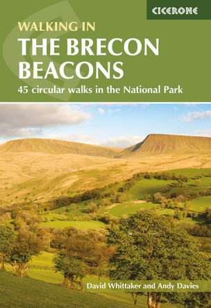
Walking in the Brecon Beacons: 45 circular walks in the National Park by Andrew Davies
RRP: €17.79Booksplease Price: €11.82Guidebook to 45 graded circular walks in the Brecon Beacons National Park, perfect for those wishing to discover the diversity of the region, away from the crowds. The routes range from 4 to 24km and cover the north-eastern, eastern and south-western... -

Walking in the Cotswolds: 30 circular walks in the AONB by Damian Hall 9781852848330
RRP: €17.79Booksplease Price: €11.82A guidebook to 30 circular day walks in the Cotswolds. Exploring the Cotswolds National Landscape across Gloucestershire and Wiltshire, there's something for beginner and experienced walkers alike. The walks range in length from 9-19km (6-12... -

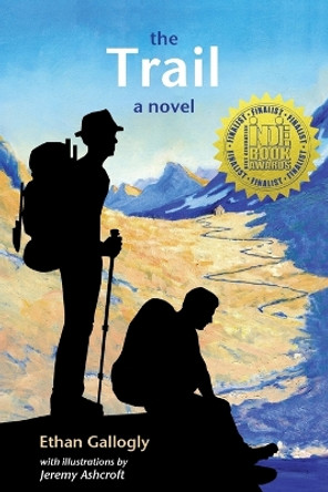
The Trail by Ethan Gallogly 9781737419204
RRP: €18.79Booksplease Price: €14.05Apologies but we at Booksplease don't have a full description for this book.Book InformationISBN 9781737419204Author Ethan GalloglyFormat PaperbackPage Count 366Imprint Sierra Nevada PressPublisher Sierra Nevada PressWeight(grams) 535gDimensions(mm)... -

Walking the Shropshire Way: A two-week circular trail including the Wrekin, Stiperstones and Wenlock Edge by John Gillham 9781786310088
RRP: €17.79Booksplease Price: €11.82This is the official guide to the Shropshire Way, which consists of a northern and southern loop that both start in Shrewsbury. Each loop can be completed in a week or combined to form a two week 182 mile (290km) circuit that visits Stiperstones, Ludlow,... -

Walking in Essex: 25 walks and a 96 mile 'across Essex' route by Peter Aylmer 9781786310224
RRP: €17.79Booksplease Price: €11.82This guidebook describes 25 coastal and inland day walks covering the whole of the county of Essex, stretching from the Lea Valley in the west and the Thames in the south over to the North Sea and up to the River Stour in the north. Walks range from 4 to... -

Walks to Waterfalls: Walks to the Best Waterfalls in the Yorkshire Dales by Neil Coates 9781908632111
RRP: €8.32Booksplease Price: €7.38This attractive and cleverly structured guide gives walkers ten of the finest walks to waterfalls in the Yorkshire Dales National Park in a popular pocketable format. With clear information, an overview and introduction for each walk, expertly written... -

Mountains of the Yorkshire Dales: A Hillwalker's Guide by Paul Hannon 9781907626487
Booksplease Price: €9.84'Mountains of the Yorkshire Dales' is the essential companion to walking the 31 rolling fells around the National Park that rise above 2000 feet. Paul Hannon's half-century of exploring the Dales has culminated in this hugely practical guidebook to... -

Staffordshire: 2021 by 9780319092057
RRP: €15.46Booksplease Price: €11.35Apologies but we at Booksplease don't have a full description for this book.Book InformationISBN 9780319092057Format PaperbackImprint Ordnance Survey/CrimsonPublisher Ordnance Survey -

Shropshire: 2021 by 9780319092040
RRP: €15.46Booksplease Price: €11.35Apologies but we at Booksplease don't have a full description for this book.Book InformationISBN 9780319092040Format PaperbackImprint Ordnance Survey/CrimsonPublisher Ordnance Survey -

Kent Pub Walks by David Staines 9781846743412
RRP: €11.89Booksplease Price: €10.26A collection of circular walks covering historic and 'best kept' villages such as Eynsford and Lamberhurst; Lympne with its cliffs and sweeping vistas; Upnor on the River Medway; the fairy-tale sight of Leeds Castle; Appledore and its ancient port;... -

Thames Valley & Chilterns: 2016 by Nick Channer 9780319090053
RRP: €15.46Booksplease Price: €11.35The Chilterns form part of the long line of chalk hills stretching intermittently across southern and eastern England. It is an area characterised by beech woods and dry valleys, and these natural features are explored in the routes. The Thames Valley is... -

How We Walk: Frantz Fanon and the Politics of the Body by Matthew Beaumont 9781804290071
RRP: €20.22Booksplease Price: €15.80You can tell a lot about people by how they walk. Matthew Beaumont argues that our standing, walking body holds the social traumas of history and its racialized inequalities. Our posture and gait reflect our social and political experiences as we... -

Beyond Bristol: 24 Country Walks by Robin Tetlow 9781911408147
RRP: €17.85Booksplease Price: €13.20Apologies but we at Booksplease don't have a full description for this book.Book InformationISBN 9781911408147Author Robin TetlowFormat PaperbackPage Count 144Imprint Redcliffe Press LtdPublisher Redcliffe Press Ltd -

The Home Counties from London by Train by Nick Channer
RRP: €15.46Booksplease Price: €11.35Are you looking to escape London for a few hours? Do you enjoy a walk in the country or a leisurely afternoon stroll, but don't want to take your car? Inside Pathfinder (R) Guide to Country Walks near London are 28 fantastic country walks all starting... -

Ribble Valley and Bowland: Short Scenic Walks by Hannon Paul
Booksplease Price: €5.94This brand-new title is one of three concurrent additions to the updated series of Paul Hannon's 'Short Scenic Walks' guidebooks. The principal feature is that all walks are less than five miles in length, offering a perfect half day's stroll for...
